Weather & road closures
Check this before you fix your dates.
Taiwan tends to have unpredictable weather and is inconveniently located in a part of the world where natural disasters happen frequently. First of all, there's the rainy season (May–June, and mid-November to mid-January) and the typhoon season (September–October), with some areas more prone to get wet than others.
Next to that, Taiwan is highly susceptible to earthquakes, with big ones having made some parts of the country inaccessible for many months. Roads may be fully closed because of major landslides, or only open at set times during the day. That requires you to get well informed and plan ahead, not to mention hours of waiting at a roadblock. It's generally advised to carefully check the weather forecasts for all areas you plan to travel to.
Usual suspects
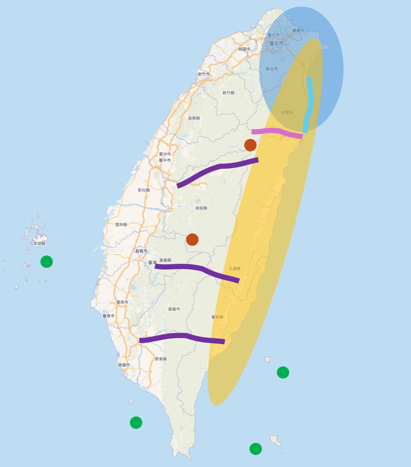
The blue-shaded area on the map is prone to heavy rainfall, especially in November and December.
The yellow-shaded part of the map is most susceptible to earthquakes and typhoons.
Frequently closed since the April 2024 earthquake; this might be solved by now. Check before you go.
Partial closures since the April 2024 earthquake; might be solved by now. Many tunnels on this stretch, which are accessible by bike but not the nicest experience.
Penghu 澎湖 and Xiaoliuqiu 小琉球 are served less often by ferry and plane in strong winds. Green Island 綠島 and Orchid Island 蘭嶼 can be cut off for days or even weeks (by sea and air) as soon as a storm or typhoon is coming. Make sure you can travel back before you even go!
Wuling 武陵 (3,275 m) and Yushan 玉山 (2,600 m) may be closed due to snowfall or exceptional weather.
A few dramatic mountain roads connect east and west in the middle of Taiwan. Officially these roads are closed to traffic, so we strongly advise against taking them by any means of transport. Persistent riders might reach the other side, but don't expect any services (food or fuel), villages or hotels along their long and quiet ways, let alone phone signal or emergency help.